[et_pb_section bb_built=”1″ _builder_version=”3.0.76″][et_pb_row][et_pb_column type=”4_4″][et_pb_text _builder_version=”3.2.1″]
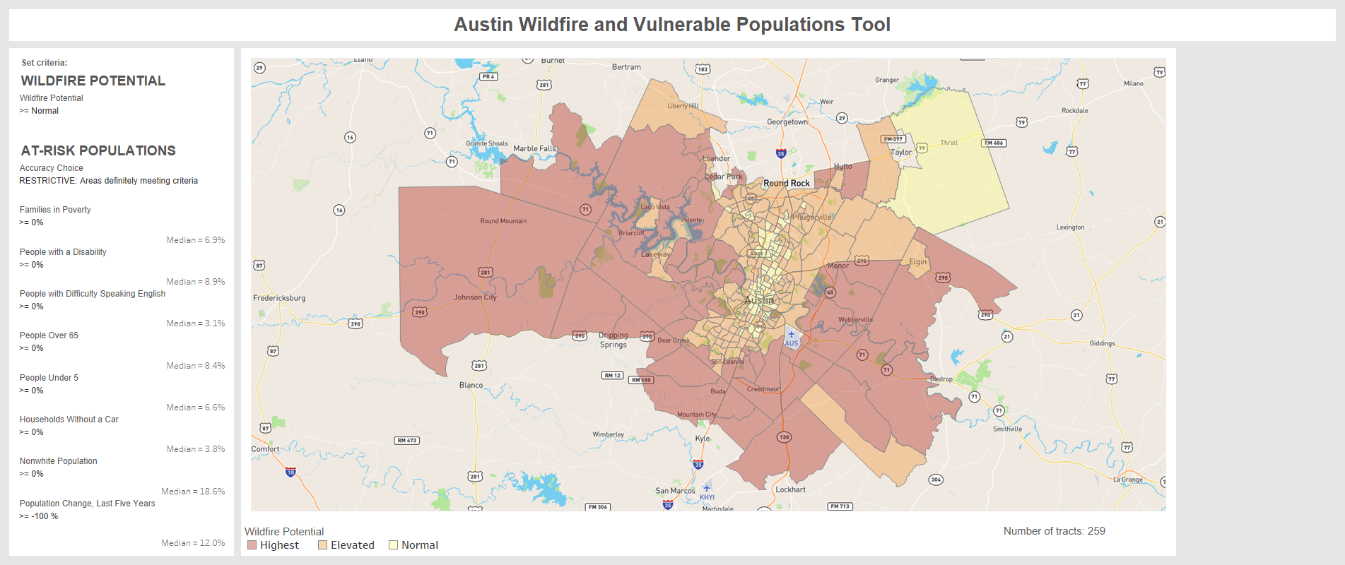
September, 2018. CPAW researchers with Headwaters Economics have release a new, interactive Austin Wildfire and Vulnerable Populations Tool. The map and underlying data help land use planners, fire personnel, elected officials, and others identify neighborhoods in Austin, TX where overlapping wildfire threats and socioeconomic vulnerabilities may make people disproportionately susceptible to wildfire. The tool supports recommendations provided by CPAW in 2016 to the city of Austin.
[/et_pb_text][/et_pb_column][/et_pb_row][/et_pb_section]