
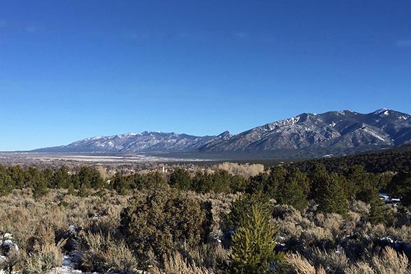
Taos County, New Mexico
Situated along the western edge of the Sangre de Cristo Mountains, the communities of Taos County are consistently exposed to wildfires. Not only are homes and properties at risk to wildfires, but local watersheds, infrastructure, and valuable historical and cultural resources are threatened, including the 1,000-year-old Taos Pueblo, a World Heritage Site. Irrigation and municipal water supplies, wilderness areas, and irreplaceable archaeological resources further complicate the wildfire landscape.
Recognizing these potential dangers, Taos County participated in the CPAW program in 2016. Working closely with the County Planning Department, Carson National Forest, Taos Pueblo, and local community leaders, the CPAW team provided technical land use planning recommendations that can be incorporated into the County’s planning documents to improve its approach to community wildfire mitigation. The CPAW team also worked with officials and consultants to develop highly detailed wildfire risk maps. In addition to helping prioritize land use planning priorities, these maps can help identify fuel treatment project locations. In 2017, CPAW worked with partners to provide feedback on updates to Community Wildfire Protection Plans, and helped develop outreach materials including a story map and brochure in English and Spanish.
In 2018, Taos County formally adopted many of CPAW’s recommendations into its Land Use Regulations. New provisions strengthen Taos County’s resilience to wildfire, and include a more clearly defined wildland-urban interface, inspection of development applications by the county’s WUI coordinator, a prohibition of residences on slopes greater than 20% in areas of highest hazard, and requiring mitigation measures in areas of highest hazard, such as sufficient water supply and roads, construction with ignition-resistant materials, and maintained defensible space.
The Taos County CPAW project is supported in part by the LOR Foundation.
Snapshot
- 2016 CPAW Community
- Population (2014): 33,084
- Growth Rate (2000-2015): 9%
- Fuel type: Pinyon-juniper, mixed conifer, shrub/grassland
Resources
- Taos County Land Use Regulations (updated 2018, 14 MB)
- CPAW Recommendations for Taos County
- Taos County Community Wildfire Protection Plan 2016
- Resilient Taos County: Living with Wildfire – a Story Map
- Brochure about wildfire and Taos (or, see it in Spanish)
- Taos CPAW Presentation (4MB)
The Taos County Planning Department is using all of the work provided by CPAW to help develop wildfire risk reduction strategies.
Nathan Sanchez
Chief Planner, Taos County