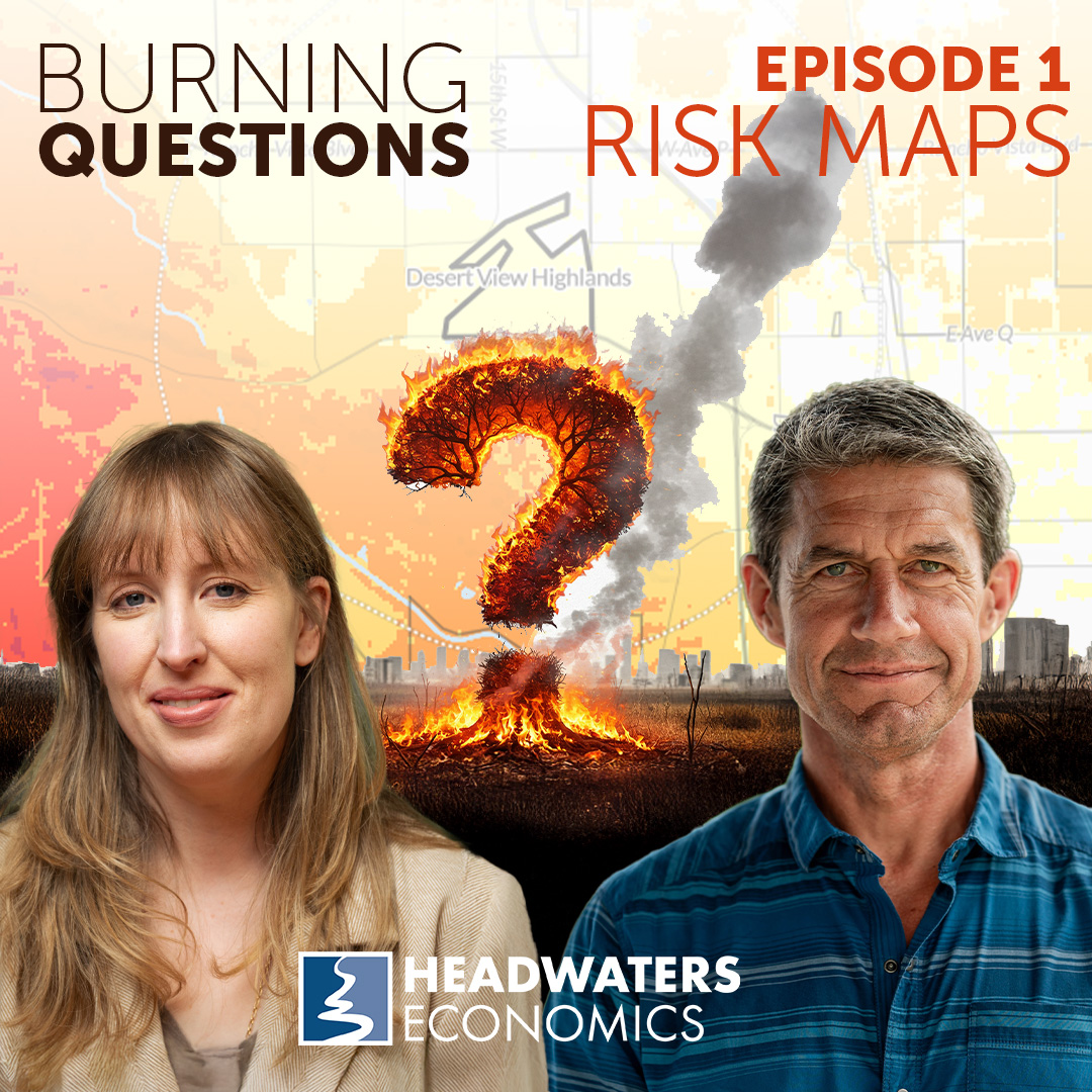
Are wildfire risk maps necessary? And will they make your insurance premiums go up?
The recent wildfires in Los Angeles show that wildfire risk maps are — tragically — very accurate. But across the United States, fire chiefs, elected officials and resident are pushing back on efforts to map wildfire risk claiming that these maps only increase insurance premiums for residents. Join Ryan and Doug in this episode to discuss the history of hazard mapping in the US and to hear, definitively, how risk maps affect your insurance.
Links referenced in this episode:
- Wildfire Risks to Communities
- California’s Fire Severity Hazard Zones map
- State of Oregon Wildfire Hazard Maps
- State of Colorado Wildfire Risk Public Viewer
This podcast is a production of Headwaters Economics and made possible by generous support from the USDA Forest Service and private foundations. This institution is an equal opportunity provider.
Episode hosts

Ryan Maye Handy
Ryan is a wildfire and land use expert for the Community Planning Assistance for Wildfire program. Her experience as an urban planner and former journalist brings invaluable insights to communities that must prepare for increasing wildfire risks.
Doug Green
Doug brings two decades of professional experience in fire departments and as a land use planner to the Community Assistance for Wildfire program. His practical insights and expertise in fire operations has supported dozens of communities working to reduce wildfire risks.
Transcript
Edited for clarity
View transcript
Ryan Maye Handy: Hi everyone, and welcome to Burning Questions, a podcast about living with wildfire. I’m Ryan Handy.
Doug Green: And I’m Doug Green.
Ryan: We are urban planners and wildfire experts for a non-profit, Headwaters Economics, based in Montana, and we help communities around the United States reduce their wildfire risk using land use codes.
Sounds wonky, I know, but bear with us. Our years of research show that the best way to combat wildfires is to think about how and where we build. So Doug and I spend a lot of time thinking about building codes, zoning, landscaping, water planning. “Why do these things matter” you say? Well, we’re going to get into that, but in short, all of these things can help your community survive a wildfire.
Today, we’re going to start by talking about one of the most fundamental things we support at Headwaters and that’s mapping wildfire risk. We are partners with the USDA Forest Service on a project called Wildfire Risk to Communities. It’s a free, easy to use website with wildfire risk maps for every community in the country and you can find it at wildfirerisk.org.
So today, we have a series of burning questions about these risk maps that I’m going to be asking Doug. And these questions include; Why do we need these maps? Why are they so controversial? And how do they affect things like home or property values or insurance rates?
These maps have been on my mind a lot recently, given the wildfires in Los Angeles, and also some of the feedback we’ve been hearing from firefighters and community members that we work with around the country. And I have to say that I think these maps are more necessary now than ever. In Los Angeles, for instance, our wildfire risk maps overlapped very closely with the fire perimeters of the Palisades and the Eaton fires, which means that these maps can be pretty accurate and can really predict where the worst wildfires can happen, given the right conditions.
But lately, there has been a lot of concern that maps like these trigger insurance rate hikes or may affect private property values, and these concerns are really growing even more as wildfire risk goes up around the country. So despite this increased scrutiny of wildfire risk mapping, we do actually have a really good history of risk mapping in the United States, and we do this, we hope, to try to predict the next disaster. And maybe prevent it.
So the best example of this, I think, is from the 1960s and still in effect today, and it’s the National Floodplain Mapping System. In the late 60s and early 70s, the U.S. government decided that it had to map flood risk for much of the same reason that we believe in mapping fire risk.
Floods were relatively predictable. They were devastating. They killed people. They destroyed communities. But while floodplain mapping is mandatory, as is, by the way, having flood insurance, if you have a mortgage on a property in a floodplain, wildfire risk mapping is not mandatory. All the same, lots of places are doing it, not just Headwaters, but no one quite does a wildfire risk map in the same way, or at the same scale, or even with the same data. And while these many different states and communities and agencies are embracing wildfire risk mapping, it’s still, as I said, really controversial. But we believe in doing it, and we want to make a case for it. So, let’s get to it.
So, Doug, I want to start with the basics here. Walk me through a little bit of what these maps show and how detailed they are.
Doug: Thanks, Ryan. First, I want to take a step back and put this situation into context. As the listeners know, the current wildfire situation has become extremely challenging and a complex problem. In the past, we always believed that we could overcome this wildfire problem through increased suppression efforts and resources. We basically felt that by buying more fire trucks and hiring more firefighters, we could solve this problem and, and it worked for a while, but as a wildfire problem, it got more and more complex and intense, we realized that this was not going to work. And we feel that one of the most important pieces to this puzzle is wildfire data and wildfire risk maps. You know, Ryan, if you think of it this way, without risk maps, we’re essentially fighting these fires blindfolded. Risk maps allow us to understand the actual hazard, to assess the risks, and to inform planning decisions so we can prioritize resources before, during, and even after a wildfire event. So with that in mind, Headwaters Economics helped develop the Wildfire Risk to Communities website in partnership with the U.S. Forest Service. And we designed this to help community leaders like elected officials, community planners, and fire managers understand how their risk varies across their community, hoping to help them prioritize actions to mitigate that risk.
Ryan: So I’m glad that you mentioned the community piece of this, because it reminds me of the thing that surprised me about these maps the first time I saw them, and that was that I couldn’t zoom in to see an individual property. Like I couldn’t zoom in to see my property here in Montana, but instead I could zoom in to see, say, the town I live in in Montana. So these maps are at a pretty high level, and I thought that was really interesting. Interesting and also different from other risk maps that I know. So why do our maps stay at this zoomed out community perspective?
Doug: Yeah, that’s a great question. And, you know, that was our intention of this project from the beginning. We realized that there was a need for a national scale project that looked at region wide wildfire risks across the country. This was really the first time that maps and data about community wildfire risks had become available nationwide. That being said, it also means these maps have their limitations, right? Listeners need to remember that the data does not reflect parcel level risks. The maps are designed to consider risks across a community or across a county, across a neighborhood and not at an individual house level. So it can give you an excellent indication of the wildfire risks, again, in your neighborhood, but we know wildfire doesn’t care about property boundaries or city limits. So that’s why we felt it was extremely important that we should have a community wide mapping project that helped direct community wide wildfire mitigation efforts, which is what matters most.
Ryan: So, let’s compare this to something that I think people might be more familiar with, which is floodplain mapping. As I mentioned earlier, the federal government maintains floodplain maps, and you can zoom in on those maps to view the parcel or individual property. Level and that amount of detail, I think, is really important for flooding because generally speaking, if your home is in the floodplain, it will trigger a requirement for you to buy flood insurance. But, as you said, wildfire maps, or at least the ones that we maintain at Headwaters only provide this broad community picture but talk to me a bit about how floods and fires are different, how they threaten homes, and how they destroy communities in different ways. Because I think that’s reflected in how we map them a little bit.
Doug: Yeah, for sure, Ryan. That’s a great question. Floods and fires are two very different types of hazards, but they’re both extremely difficult to map. Flood mapping does have a head start on wildfire mapping, as we’ve been attempting to map flood risk on a national scale for more than a half a century. Floodplain mapping is not perfect though, and there’s still some inaccuracies with it. Like flooding, we can map where wildfires are most likely to occur and what communities might be affected. And again, that’s what these maps on Wildfire Risk to Communities show. Unfortunately, we can’t predict where and when the ignition source will be. We can’t map the variables that consistently change and affect how and where a fire will burn.
And as we know, wildfires primarily ignite homes with embers, or basically little sparks or burning pieces of ash, which can travel miles ahead of an actual flame. And these embers ignite landscaping, bark mulch, and debris and gutters, which can all cause a home to ignite. And what’s interesting is the commodity we are trying to protect, the home, is also the one that can substantially increase the threat to the hazard. We need to remember that homes, cars, boats, and landscaping can all exponentially increase a wildfire’s potential. Meaning that although you may have been able to accurately map the wildfire risk at one moment in time, as houses are built and as landscaping grows, the risk dramatically changes.
Ryan: So if I understand you correctly, these wildfire risk maps contain a lot of information about vegetation and the type of landscape, but they don’t include a really important part of what causes a wildfire to spread, and that’s, a structure on a piece of property. So as you said, part of what burns during a wildfire is a home, and so then if that home is fuel for fire, it should ideally be reflected in the risk. It’s not, is that right?
Doug: Yeah, you’re exactly correct. And that’s one of the big deficiencies when it comes to wildfire risk maps that are out there. Now, fuel packages like homes and RVs and outbuildings are not included in most wildfire risk maps, mainly because the science behind it has not caught up to the mapping process. Unfortunately. What happens because of this is when we look at wildfire risk maps around communities in a lot of cases, it will show the risk being really low in those communities, and that’s not because the risk is actually low. It’s because those risk maps look at vegetation as the fuel package and in communities. Obviously, there’s less vegetation and trees and more homes. Obviously, with homes containing such high amounts of combustibles, it can, again, exponentially increase the risk of wildfire in those areas.
Ryan: So I think this is a good place to start talking about the other kinds of wildfire risk maps that are out there. not everyone takes the same approach to mapping the risk the way that we do at Headwaters, and there are actually several really good examples of different types of wildfire risk maps in the United States right now. Some of them, I just have to say, are still going through the public approval process. So, while you can find them on the Internet, they may not be officially approved or in force. So these maps are in California, Colorado, and Oregon. Some of these states have parcel level information, which means that you can zoom in to see your specific property and see your risk, and you can also see your neighbor’s risk, So it’s a very different understanding of how wildfire impacts a community and different residents. I know that in some states like Colorado and Oregon, these maps are embroiled in a lot of public debate about how they are used and how they are created.
So I was hoping you could talk a bit about what is the controversy here? Why are these parcel level maps in particular so difficult?
Doug: Yeah, well, there’s a couple answers to that question. First of all, you’re right, there’s been a long history of tension over maps. And so the debate part is hardly new. When we’re in communities, the concerns we hear the most from community members and decision makers include; Are they accurate? Why am I in a high risk area or my neighbor across the street is not in a high risk area. Are those maps going to restrict what I can do on my property, and will it make my property harder to sell or lower my property value in a big way. Right now, obviously, how are these maps going to infect the insurance rates of my home? Are they going to increase the rates? Are they going to cause the insurance company to drop my policy altogether? And so communities are kind of caught in the middle of this debate right now. Community members obviously want to avoid wildfire risks just so they can protect their friends and family. Fire departments want to know where the risks are and how they should prepare, and land use planners and community decision makers want to know where they should allow building to occur and where they shouldn’t allow it to occur. But on the other hand, the community and the public don’t want those maps to be used against them, whether it’s restricting what’s built on their property. Or having insurers drop them based on that map.
Ryan: So, To me, few things epitomize these tensions you’re talking about more than what’s going on in the state of Oregon right now. So Oregon has been locked in a battle over their wildfire risk maps for a number of years. They’re actually currently in the middle of trying to repeal their second effort to map their state wildfire risk. And I think all of this effort to map the risk came out of a really destructive summer of wildfires in 2020.
Doug: Being from Oregon and still living in Oregon, I’ve seen this process and how it’s played out. And it’s an interesting challenge and there are a lot of lessons to be learned for other states or regions that are trying to adopt a WUI code. Oregon had the right idea. I think they would admit that there’s probably some things they would do differently, but the idea was sound and there have still been a lot of good things that have come out of that in terms of funding for state project defensible space mitigations and technical assistance to communities around the state. The mapping piece was the big challenge. Oregon did have a series of devastating wildfires in 2020. The worst, really, in the history of Oregon. And that’s what inspired the state to take steps to reduce their wildfire risk. Part of that process was to develop a statewide wildfire risk map that showed the risk at a parcel level and also included mitigation requirements depending on what hazard you were in. It kind of followed the California model that has been down there for many years. When it was first released in 2022, it was retracted pretty quickly because of public pushback. Oregon then relaunched it this last year. With some changes to it. But like you said, Ryan, there’s already efforts to repeal it because again, misconceptions about the map, what the map will be used for. People in Oregon are no different than anywhere else in the country. They’re worried about what these maps will show. They’re worried that it’ll lower their property values. They’re worried that it’ll trigger insurance rate hikes and that they aren’t accurate at the ground level. And the big piece of these maps that caused so much contention was that there are regulations tied to it. And people were worried that they were going to be forced to do things to their property that they did not want to do. And they weren’t clear about what those regulations actually meant. But that’s how these maps are supposed to work, right?
Ryan: They’re supposed to identify places where the risk is high and try to lower that risk. So Oregon was on the right track. Um, it just is a challenging thing to try to adopt anywhere. And, I know that we really get this tension between the right to do what you want on your property and the concerns over your property value and your insurance prices, but also the need to reduce not only your risk, but your communities risk and the big thing I think about here is we ultimately want it to be affordable for people to build and rebuild in their neighborhood and to protect their homes and the communities they live in, but on the other side of this issue, the other half of this tension is that we know these catastrophic wildfires keep happening because a lot of communities don’t know their risk or haven’t accepted it and haven’t taken the steps they need to address it. I know the big challenge with this is not the science piece. We understand the science, we understand that the risk challenge here is the social science piece.
Doug: It’s helping communities understand. the real risk to the community, not the perceived risk, because we often find that is very different. And if we can get communities to understand the real risk, then the biggest hurdle for us helping them make those changes is already done.
Ryan: If you can tie it to other priorities and values in the community, and move forward with not only reducing the wildfire risk, but also dealing with air quality, or houselessness, or other values in the community. If you can tie them all together, then it has much greater traction in moving it forward and people then will support it.
Doug: I think one of these other things that you can tie reducing wildfire risk to is insurance. And incentivizing people to understand their wildfire risk, address it because it may ensure that their home is insured.
Ryan: In the future, I don’t think that we can say that insurance companies will definitively lower their premium. Can we say that taking steps to reduce your risk can
Doug: confidently that until we reduce risk at a community level, the insurance companies are not going to come to the plate and bat. That’s not saying that if we do these things, there’s a guarantee they’re going to. But there is no reason for them to take that risk if the community doesn’t have a stake in it as well. They need some skin in the game.
Ryan: Hey, everyone. This is Ryan Handy at Headwaters Economics. I just want to thank you for listening to this podcast. It’s a new effort here at Headwaters, and I hope you will share this episode with your friends, your coworkers, and your community members. If you have any topics that you would like us to address on the podcast. Or if you have any of your own burning questions, please email them to me at ryan@headwaterseconomics.org.
So all wildfire risk maps, whether the ones that the Forest Service has released publicly, or the ones maintained by states, all of these rely on a base set of federal data. data that, again, the U. S. Forest Service collects. So that means, in a certain sense, all of these maps have a similarity, but different groups or entities can decide to add different variables, which can change some of the looks or results of the maps. And at Headwaters, I think we don’t have a position on which type of map or combination of variables is better or worse. We are mainly invested in a community mapping their risk so they can take steps to reduce it. We think there are uses for a federal raw look at wildfire risk, but there is also a need for specific parcel level information and data. And that’s the type of data that you need to assess the actual wildfire risk on a specific property. It’s also the data that insurance companies need to price out an insurance policy.
So here’s where I need to ask my million dollar question. Do wildfire risk maps cause insurance rates to go up, or do insurance companies use maps, like the ones that we maintain for the Forest Service, to determine how much a policy should cost or if a policy should be offered at all?
Doug: Ooh, yeah, loaded question, Ryan. That’s a good one. It’s a complicated issue, and it’s going to have a complicated answer. So I’ll start by saying that wildfire risk maps Should reflect your risk, but they don’t determine your risk, right? You have the ability to change your risk to your home and your property by doing mitigation measures to your landscaping or by hardening your home. And if you live in an area that is historically in a wildfire prone ecosystem, then you’re at risk, whether it’s mapped that way or not. And we know that more than one third of Americans live in high wildfire risk areas. So as to the insurance question, yep, they use wildfire risk maps, but they create their own maps using proprietary data that unfortunately isn’t shared publicly. Which can cause frustrations to policyholders that have their rates increased or their policy dropped. And don’t get any clear explanation to why that happens. Some states, including Oregon and California, actually prohibit insurance companies from using the public risk maps to determine the premium and rates. So, yeah, insurance companies do use risk maps. They have to use risk maps. Just like Fire departments need risk maps. They need to understand where that risk is and where the value to them lies, you know, for insurance companies, it wasn’t really until the last 20 years where the wildfire piece played a huge role on how they cost out policies. The wildfire piece was out there, but it was usually hurricanes and floods and hail damage that reflected most of their payouts. Obviously that’s now changed. So the insurance companies are trying to catch up. They’re trying to learn about mitigation measures and strategies. Which ones work and which ones don’t work. And I truly believe that they recognize that efforts at a community scale make a difference. And that in the future, community wide mitigation will convince insurers to stay in the game. So, is there a guarantee that if a community does everything right on a neighborhood scale, let’s say the insurance companies are going to come in and cover them or lower their rates? No, there’s no guarantee of that. But I can tell you that the only way the insurance companies are going to come to bat and want to play ball is if things are done at a community wide scale. And that’s what the goal of this all is.
Ryan: Yeah. So to bring this back to risk maps, When a home is burning, as you said, it spits out all these little sparks that then can travel for miles to ignite other homes in the community. So if you live within two miles of someone who has high wildfire risk, your home also is potentially at risk, which is why I think, one, we encourage an entire community, as you said, to invest in measures that will reduce their wildfire risk. And then, two, because that’s really the only way that this is going to be effective, which is why we map wildfire risk at such a large scale, because it is.
Doug: You’re correct and insurance companies know all the latest science on this. And that is why it is so challenging for them to cover a policy on an individual home without looking at community wide maps.
Ryan: So I think what we’re getting at here is because we don’t have a federally mandated wildfire risk mapping system that we’ve ended up with a sort of patchwork of risk maps. We have the maps that we maintain for the U. S. Forest Service. Which are national, but not parcel specific, and there are communities who can afford to map their wildfire risk and many others who can’t and many others who still may not see it as a priority and therefore do it. And I’m not saying that, you know, one of those maps is wrong and the other one’s right. What it is, it’s confusing, and we don’t blame people for being baffled by these maps. I mean, there isn’t a national standard and it’s kind of obvious and it’s, you know, how do you understand what your risk is when different tools rate it differently?
Doug: We have to remember that mapping and wildfire risk mapping in general are models. And models are inherently faulty at a certain level. And depending on what input you put into there, you’re going to get different levels of risks. And some maps use vegetation as their input. Some maps use prevailing winds as their input. So depending on what parameters you put into those maps, the product that comes out of that map can be very different. And like we said earlier, we need to remember that things that burn really hot, like RVs and outbuildings and homes, when this fire enters a community, are not always safe. Included in those maps, you know, and that’s where the real risk lies. And we saw this in LA, we saw this in Maui, we saw this in Colorado, those areas that may not have been high wildfire risk based on certain risk maps had extremely high wildfire rankings at other risk maps, especially when you take into account other parts of that community that were not included in the risk map.
Ryan: So I’d like to bring this back to the fundamental reason we map wildfires. And that’s it. It’s out of a desire to protect lives and properties. And this is why we want to predict where fires are going to be so that we can, as you said, identify the areas that are at the greatest risk and reduce that risk. And I know this is pretty personal for you because you spent a couple of decades in the fire service where a lot of what you did is dictated by limiting risk to lives.
Doug: Yeah, it is personal. I mean, I spent 25 years in a structural fire department. And when you’re in the fire service understanding the risk before it occurs is crucial in that profession, we understood and mitigated As much risk as possible before an event ever occurred. We trained on it daily over and over and over again. And that’s how we made the risks we took manageable.
Ryan: And to zoom that out more broadly, I mean, that’s why we do things like mapping floodplains. It’s why we install smoke detectors in homes. We know that fires in homes can kill people. So we’ve learned how to predict disasters and respond in ways that Reduce the loss of life. And these risk maps are just another iteration of that.
Doug: Yeah, you’re right, and the wildfire risk maps and wildfire codes are really behind the curve on this. They’re no different than other codes out there that are designed to protect people. And we need to remember that codes are built on the backs of tragedy, right? They’re designed to protect us. They were written and developed after tragedy struck after people were killed after buildings collapsed, after buildings burned. We understand how communities burn. We know the science, we know how to protect people and protect communities. We don’t want to keep making these mistakes over and over again. We don’t want to have to live through another L. A., another Lahaina, another Marshall Fire or Paradise Fire. We know how to keep those things from happening. It’s just, do our decision makers have the fortitude to make those tough choices to catch the wildfire risk maps up to what all the other hazards already know.
Ryan: I think that’s a really good place to end it today. We really encourage everyone to take a look at a wildfire risk map, whether it’s the one maintained by your community or your state or the one that we maintain at Headwaters for the Forest Service. You can find that map at wildfirerisk.org and you can look up your community there and that page also has a lot of information about how you can ready your home for a wildfire. Thanks Doug so much for chatting with me about this today.
Doug: Hey, thank you, Ryan.
Ryan: And we’ll be back with another episode when Doug and I will be discussing urban conflagrations. Thanks for joining us.